LONG RANGE FORECAST OUTLOOKS 4/19/2026
Presented by:

The Long Range Forecasts and outlooks are brought to you by First Strike Environmental. Providing emergency response and management of hazadous materials incidents and also response for wildland fire fighting, First Strike is the first call of many state and federal agencies. They are a Southern Oregon family owned company in Roseburg. Proud to support Rogueweather.com.
6 TO 10 DAY OUTLOOK
This covers the time period of the 25th to 29th. There is getting to be considerable belief that May is going to be seeing a lot of summer like conditions in the Northwest and Northern California. You can see above average temps working in. We are still seeing above average chances for rain down east of the Cascades in Oregon and in California. But, the change is underway.

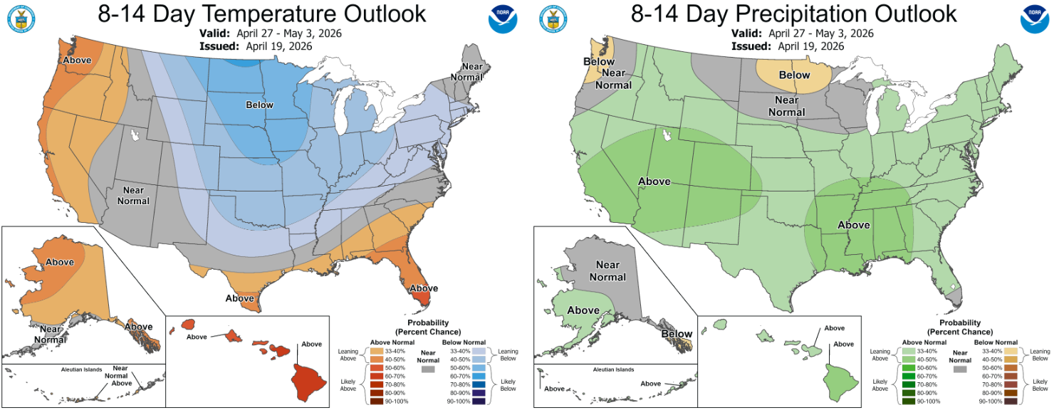
8 TO 14 DAY OUTLOOK
This covers the time period of the 27th of April to May 3rd. Now you can see the switch to above average temps takes hold on the West Coast. The wetter than average potential in California is looking very front loaded here. Meaning that it is likely going to happen before May 1st.

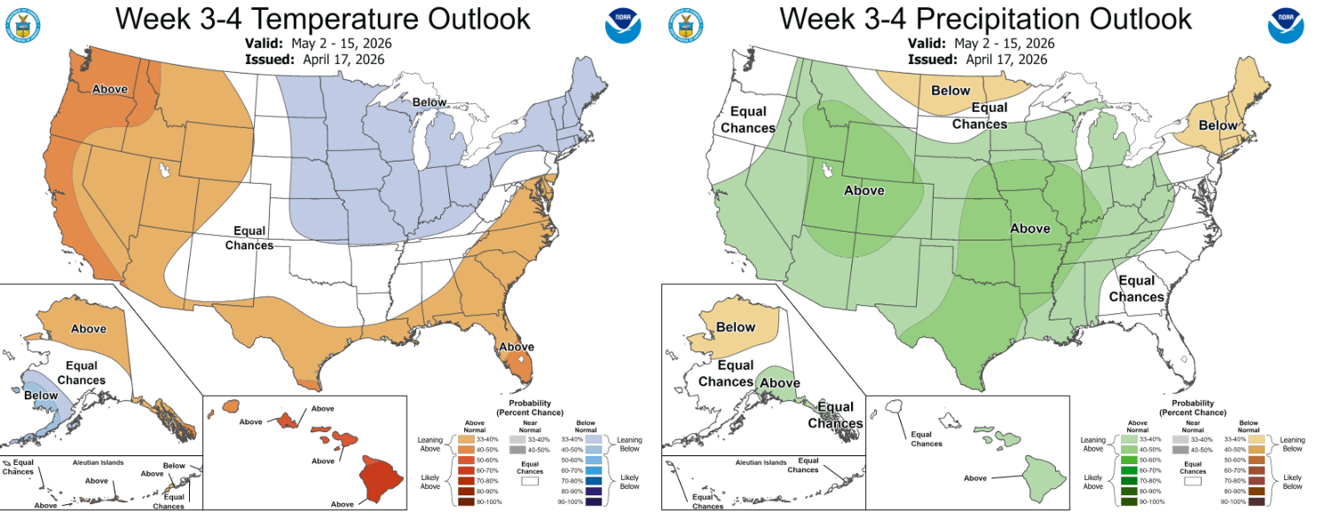
3 TO 4 WEEK OUTLOOK
This is covers the time period of the 2nd of May to the 15th. The only surprise here at this point is the potential to see wetter than average conditions in California. Because looking at other long range sites shows that California is going to be bone dry after May 1st. We will see how this turns out.
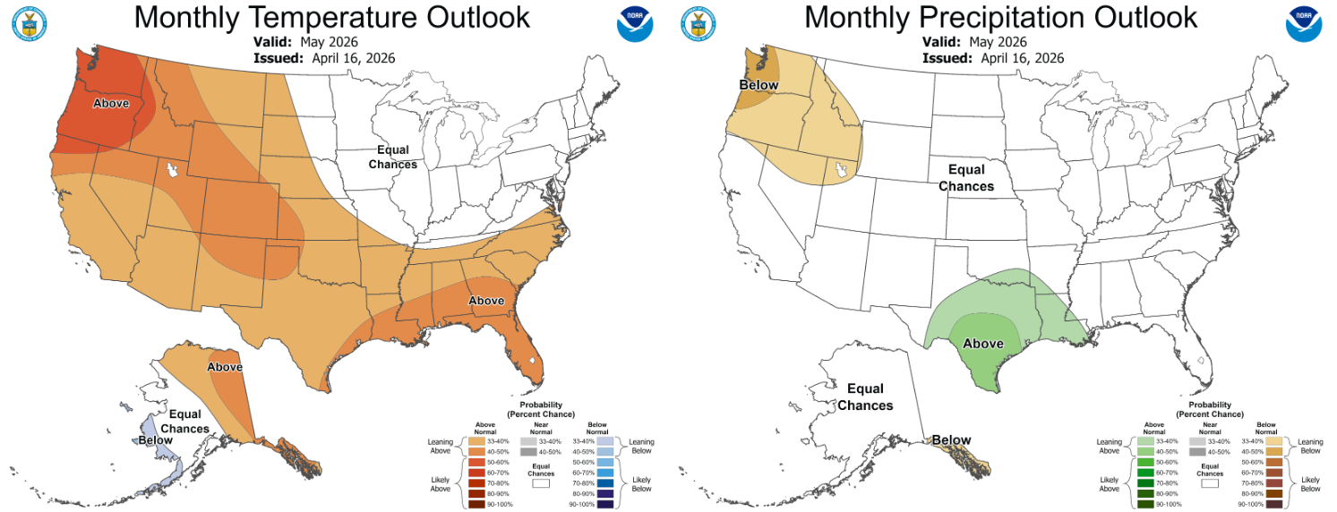
MAY MONTHLY FORECAST
May is going to see an early arrival of summer as things look now. Especially in the Northwest as it is looking like a lot of days of hot weather and dry conditions. We should see fire seasons getting declared in May in Oregon and Washington.....and portions of California as well. The way this looks, Memorial Day Weekend is looking to be in the 90s for sure.....and possibly knocking on 100's door. And, in this set up...any rain to be seen is going to be out of convective showers and thunderstorms.

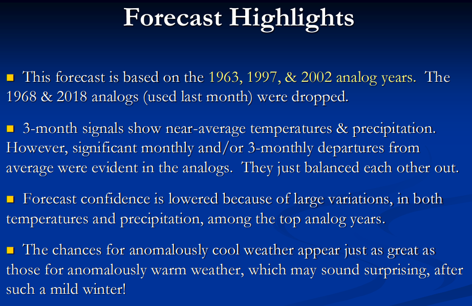
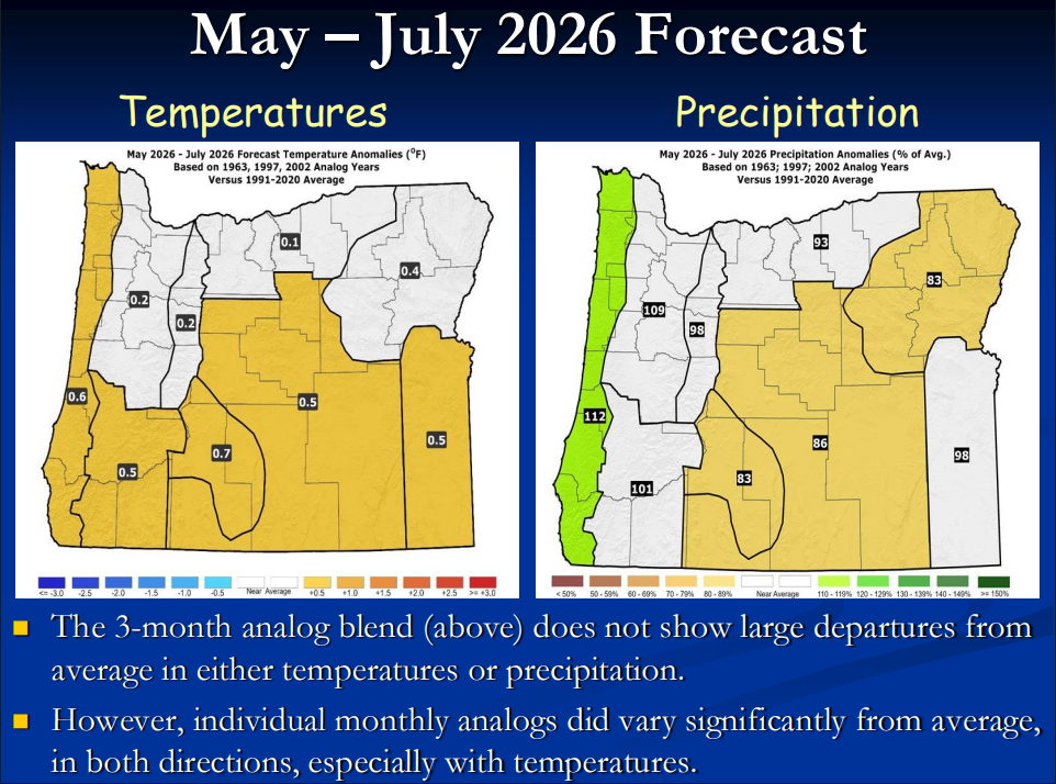
First up is the 90 day forecast from Oregon Department of Forestry Meteorologist Pete Parsons. Pete is a very good longer range forecaster. He is basing his forecasts on what has happened with years where we had similar climatic conditions. He has found that 1963, 1997, and 2002 had conditions much like we see now. Many times the solution to forecasting the future is to look at the past and similar conditions. Pete does this. Pete has a lot of information in his three month outlook. Click on the second image below to read Pete's report. As you are going to see, Pete and NOAA Climatology are not on the same page at all. One of them is going to be proven right.

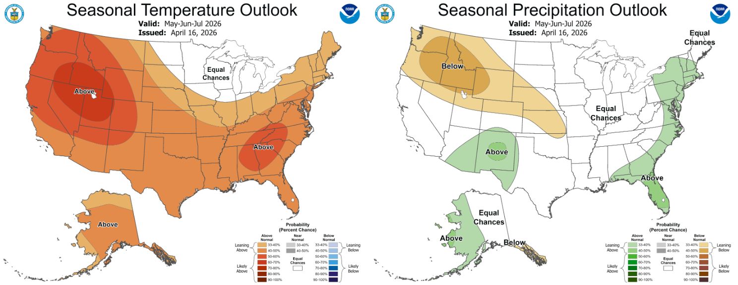
Here is what NOAA is forecasting for May through July. As I said, they are the opposite of what Pete said. Who is going to be right? We will see
NOAA Climatology also has this as the drought expectation. Coming out of the winter we did not have......this is not a surprise.


